Miran Jani

About - Miran Jani
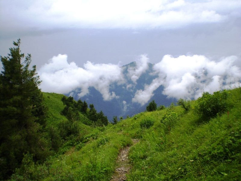
Miranjani is highest peak of Galiyaat region in lower Himalayas at approx. 9700 ft ASL. The trek starts near Nathia Gali which is host to two beautiful one day trekking excursion being Miranjani and Mukshpuri peaks. When trekking, put on comfortable shoes or boots. It will keep you cosy and serve as a cushion. The Miranjani hike is quite slick in the winter.
Miranjani is the highest peak in Galyat Region which is located at the elevation of 2,992 metres, in Abbottabad District of Khyber Pakhtunkhwa the Province of Pakistan. It is located in the Namli Maira area, in Ayubia National Park, in the western Himalayan range. Miranjani has well know trekking trails, Private Tours for Families, Friends, Corporate, Schools or Colleges are also held here during summer season. Among many attractions of Abbottabad this peak is relatively is easy and fun to climb.
The Miranjani trek starts a few minutes’ drive away from the Governor House in Nathia Gali. The total length of the track is about 4.69 km and a net elevation of about 600 meters. Most of the path is soft dirt sparse with small rocks patches and hence is very easy to traverse with little effort. Intermediate to expert trekkers should be able to do it in 1 hour 15 mins to 2 hours. Beginners should also have no trouble and would be able to complete in 2-3 hours. The path to the peak is canopied with tall trees and is abundant in greenery. Nathia Gali, Mushkpuri Peak and Azad Kashmir are easily visible from the top. On a clear day even Nanga Parbat, the ninth highest mountain in the world, at a displacement of 166 km or a distance of more than 400 km can be seen shining with its snow clad peaks. Great place for family tour and hiking. Both demographics can visit this area for hiking as it’s not too challenging. The hiking can be done solo or in groups which takes approximately 2 to 2 hour and 30 minutes to complete.
میرانجانی
میرانجانی گلیات ریجن کی بلند ترین چوٹی ہے جو پاکستان کے صوبہ خیبر پختونخواہ کے ضلع ایبٹ آباد میں 2,992 میٹر کی بلندی پر واقع ہے۔ یہ مغربی ہمالیائی سلسلے میں ایوبیہ نیشنل پارک میں ناملی مائرہ کے علاقے میں واقع ہے۔ میرانجانی کو ٹریکنگ کے راستے اچھی طرح معلوم ہیں، گرمیوں کے موسم میں یہاں خاندانوں، دوستوں، کارپوریٹ، اسکولوں یا کالجوں کے لیے پرائیویٹ ٹور بھی منعقد کیے جاتے ہیں۔ ایبٹ آباد کے بہت سے پرکشش مقامات میں سے یہ چوٹی نسبتاً آسان ہے
میرانجانی ٹریک نتھیا گلی میں گورنر ہاؤس سے چند منٹ کی دوری پر شروع ہوتا ہے۔ ٹریک کی کل لمبائی تقریباً 4.69 کلومیٹر ہے اور اس کی خالص بلندی تقریباً 600 میٹر ہے۔ چوٹی کا راستہ لمبے درختوں سے ڈھکا ہوا ہے اور ہریالی کی کثرت ہے۔ اوپر سے نتھیا گلی، مشک پوری چوٹی اور آزاد کشمیر آسانی سے نظر آتے ہیں۔ فیملی ٹور اور پیدل سفر کے لیے بہترین جگہ ہے۔ہائیکنگ اکیلے یا گروپس میں کی جا سکتی ہے جسے مکمل ہونے میں تقریباً 2 سے 2 گھنٹے اور 30 منٹ لگتے ہیں۔
Location / Address
Abbottabad, Khyber Pakhtunkhwa, Pakistan